mapsDay 2 – Lines – Philly Street Directions
Day 2 - Lines
Challenge Description: Map linear features (e.g., roads, rivers, migration paths, flow lines). Explore line thickness, color, and direction to convey information.
My Submission
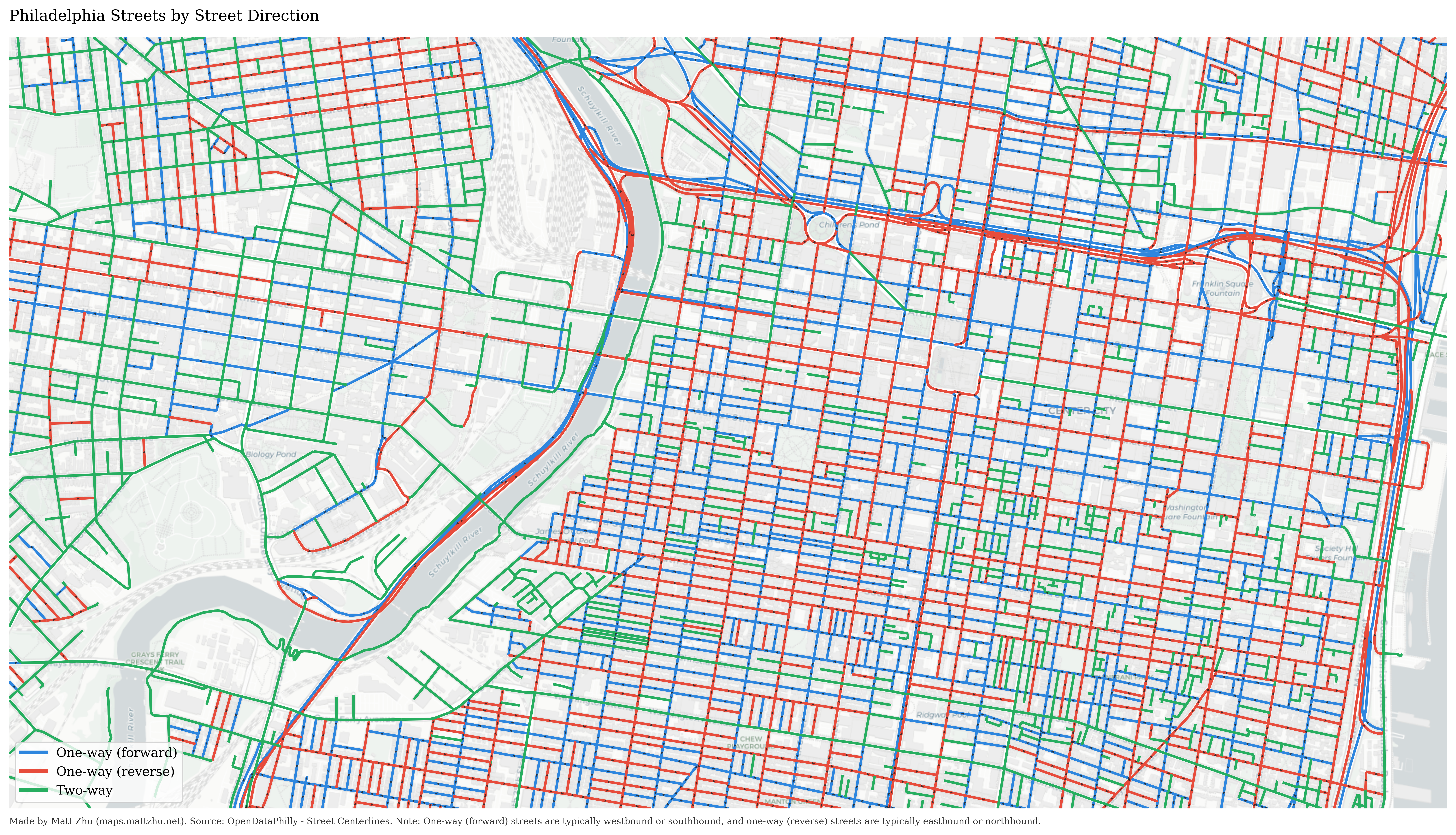
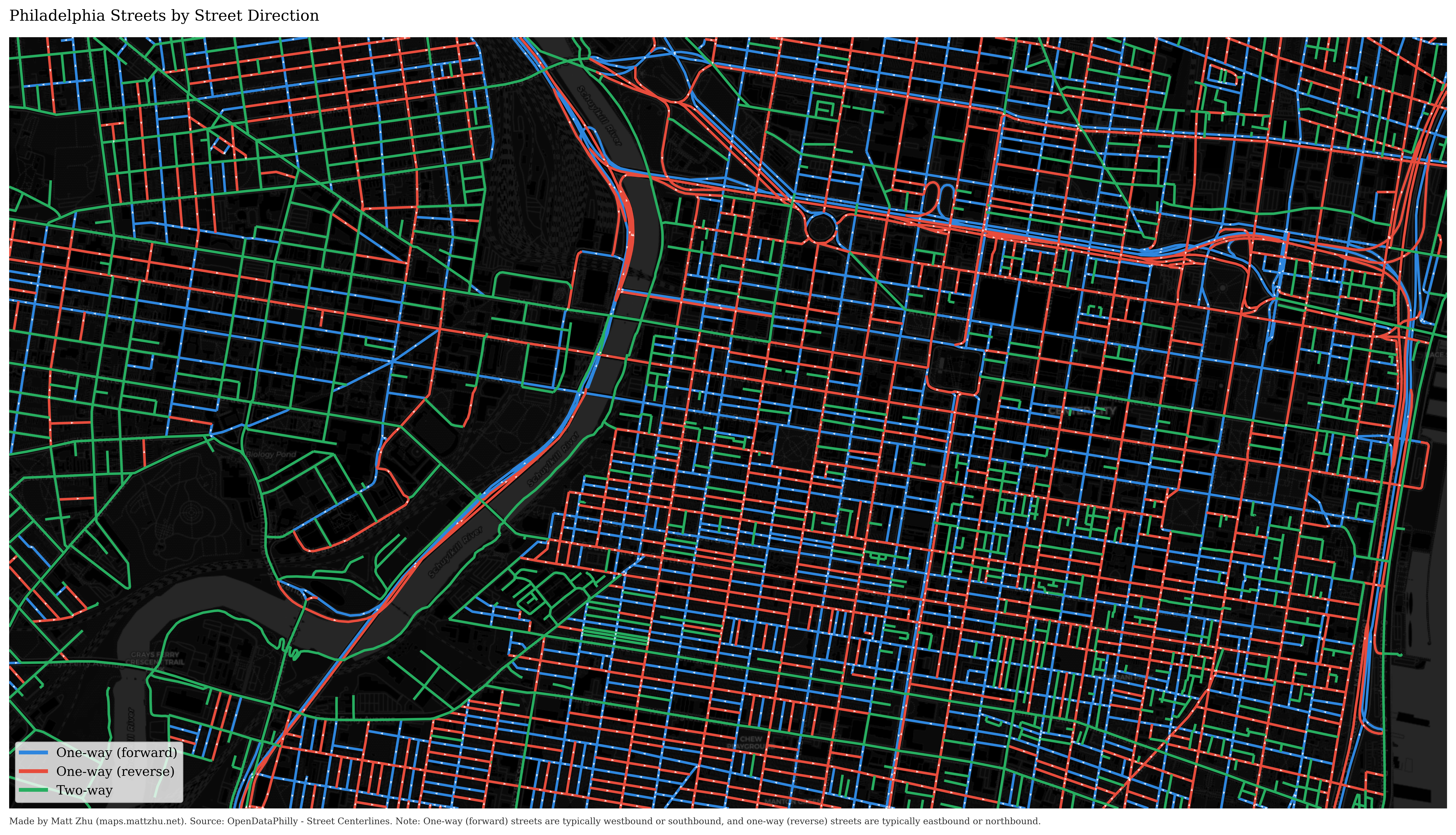
Driving in Philadelphia feels really different from driving in North Carolina. I didn’t realize there are so many one-way streets, often with opposite directions right next to each other.
I made a map that visualizes Philadelphia’s street directions, based on the city’s official Street Centerlines dataset.
Each line segment represents a street block colored by its travel direction:
-
🟦 One-way (forward) — typically westbound or southbound
-
🟥 One-way (reverse) — typically eastbound or northbound
-
🟩 Two-way
Two styles (grey and dark) are shown below:
 Click here to view high-quality PDF ⬆️
 Click here to view high-quality PDF⬆️
References
-
Source Data: OpenDataPhilly - Street Centerlines
Made by Matt Zhu for the #30DayMapChallenge.